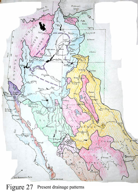
Figure 27 shows the situation of modern regional drainage basins.
The Colorado-Green River basin begins at a major divide above Grand Teton National Park, Wyoming. All the areas colored pink on the map are closed basin regions where the water has no way of reaching the coast. Note the small closed basin retaining the Salton Sea and Palm Springs in California. The Colorado Plateau is outlined in a double purple dashed line through which the Green-Colorado River flows. Most of the Great Basin lies off the map, covering all of Nevada and adjacent areas.
Basin and Range faulting formed many valleys, most of which contained streams that were initially isolated from the neighbors. As the valleys filled with sediment, rivers began to connect between valleys. These days most valleys in southern Arizona have streams that exit to the Gila-Salt River that flows to the Colorado and to the Sea of Cortez. One would expect that the rivers would remain in the valleys to accomplish this feat of drainage, even if they do 'U-turns' around entire mountains, like the Santa Cruz does in Sonora. In part this is so, but not always. If you examine the Gila River's path you will see anomalous zones where it flows down a valley, then makes a sharp turn and cuts a gorge through a mountain range. (The course of the Salt River is shockingly parallel, another problem.) The Gila does this zig-zag four times, with four gorges including the one called the 'Gila box' upstream from Safford.