Cabeza Prieta Natural History Association
Childs Mountain Tour
Location
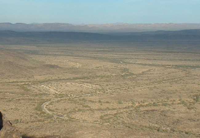
Childs Mountain, located almost 1,500 feet above the desert floor (2,800 feet above sea level), offers a panoramic view of the surrounding Sonoran Desert including parts of Cabeza Prieta National Wildlife Refuge and the Barry M. Goldwater Air Force Range. Typical of the regional geologic features visible from its summit, Childs Mountain is an uplifted, old lava flow. Substrate on the mountain and slopes is composed of shallow, clay silts and caliche nodules can be noted.
The Ajo Radar Station, located on Childs Mountain, was constructed by the U.S. Air Force in 1956 to 1958. Operations at the station were terminated in 1971 and the facility was abandoned the following year. The current radar station, often referred to as the golf ball, was constructed in 1998.
Many of the roads which had been created during the Air Force project were back graded and hill contours restored. The bluff area of the site was re-seeded with a mixture as specified by the U.S. Fish & Wildlife Services (USFWS).
As of October 2002, the remedial action, by Air Force, at the Ajo site has been completed. The USFWS has accepted the remediation activities as complete as it pertains to the Cabeza Prieta Wildlife Refuge.
|
||||||||
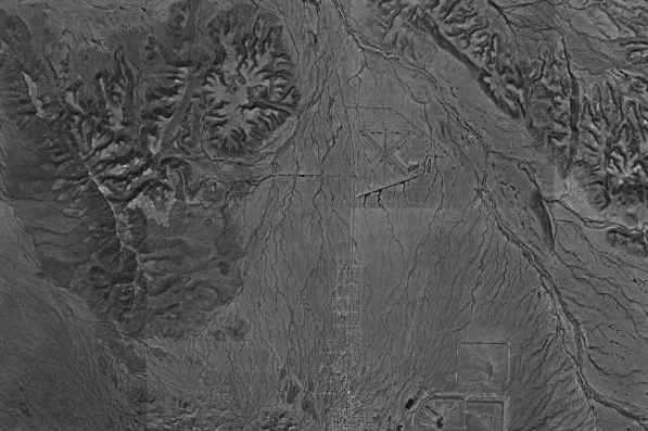
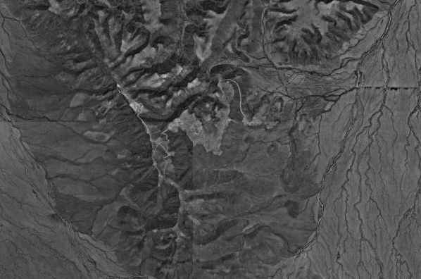
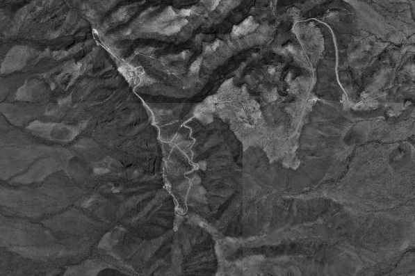
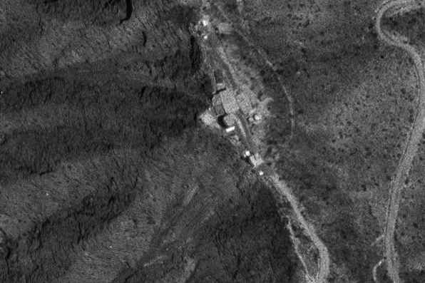
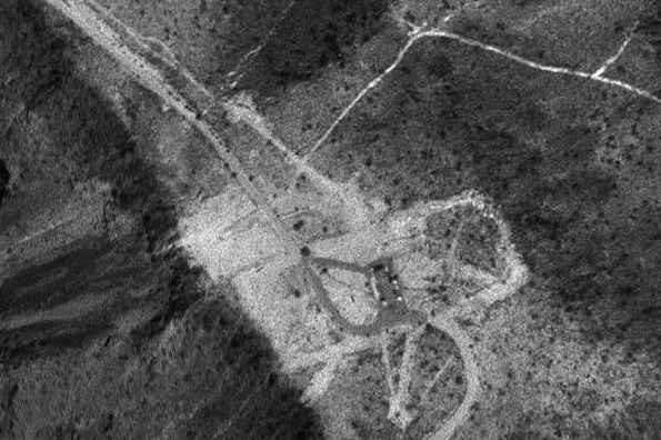
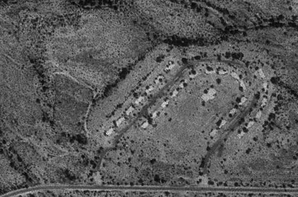
Photo Views
- North end of Ajo to the Ajo Airport on the right and Childs Mountain on the left
- South end of Childs Mountain shows current road, recently removed roads and barrics
- Top left is the radio station, down to the old radar station, with the current desert view point between
- Zoom-in on the old radar station
- Zoom-in on the current view area, before it was returned to its natural state
- Abandoned barrics which were located at the base of the mountain - Photo #2 shows this area, about a ¼ of the distance from the right frame. Here is a photo of the barrics area taken January 28, 2006.
The road to the summit was built during the late 1950's to service a US Air Force installation built as part of the continental radar system. Constructed at a cost of $15 million, the facility was intended to provide early warning in case of a Soviet bomber attack, but was obsolete by the time it was completed. However, the operating base, to which between 125 and 175 men were assigned, continued in use until 1969 when it was abandoned and the personnel were reassigned. The updated radar facilities located on top of the peak are remotely operated and are still in use.
The road to the summit is locked and off limits to the general public, except during Cabeza Prieta Natural History Association Tours. Volunteers will be available to answer questions.
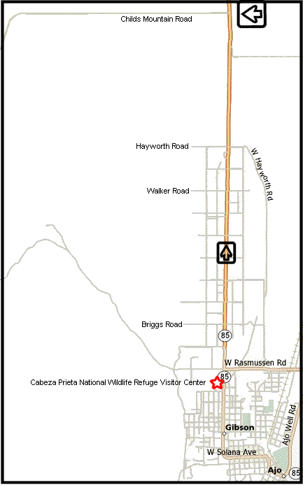
To reach the summit, take Childs Mountain Road, which is paved but is not in good condition, west from Highway 85. The turn is located between mile markers 36 and 37, approximately 4.25 miles north ofthe Cabeza Prieta parking lot in Ajo.
Please note that there are no rest room facilities at the location.
Check our Calendar for Childs Mountain Tour dates which occur from January through March.
Copyright Creative Commons
HTML & Programing by
Thomas R. Powell