PHOTO CAPTIONS - how to get labels on them?
DSCO2359.JPG Fig 22A
2360 Fig 4A
2361 Fig 19A
2362 Fig 13A
2363 Fig 26
2364 Fig 15
2365 Fig 19B
2366 Fig 24
2367 Fig 14A
2368 Fig 25
2369 Fig 5A
2382 Fig 23 (re-photo to include missing edge)
2383 Fig 23 (close-up of missing edge)
photos of important rocks and fossils. To include, or not? Where?
Fossils:
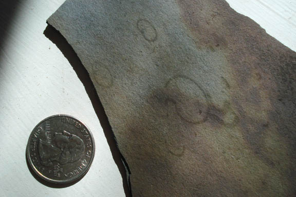
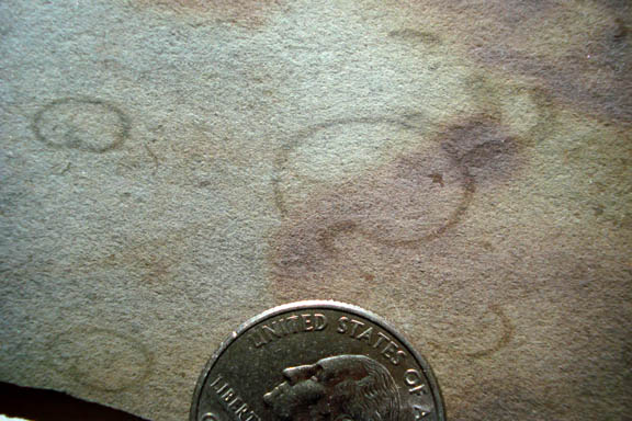
- 2370 and 2381 Grypania spiralis, oldest know complex cellular organism (eukaryotic) -- a marine floating algae? Preserved in seabottom muds, from Ontario Canada.
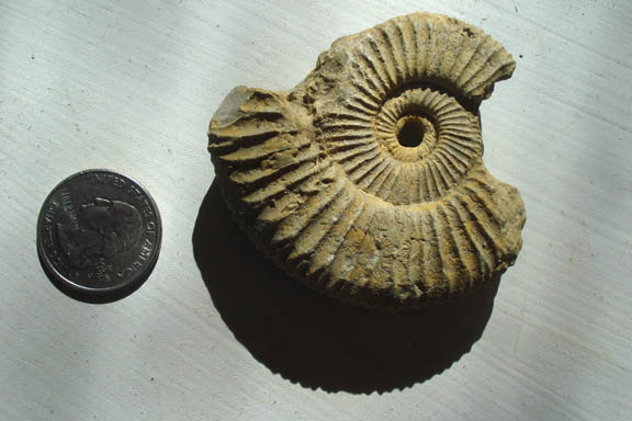
- 2371 Ammonite fossil, Jurassic age. The Mesozoic seas were filled with hundreds of species and billions of individuals. They went extinct with the dinosaurs -- a close living relative is Nautilus.
- 2372 and 2380 Slabbed views of banded iron formation, formed around shallow water hot spring vents, but the oldest known fossil form on Earth, from Australia, this specimen about 2,500 m.y. old.
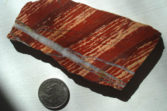
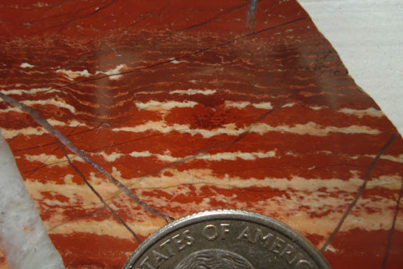
- 2373 View from above of a small stromatolite colony fossil, from Australia. The oldest known photosynthetic organism, a colonial bacteria.
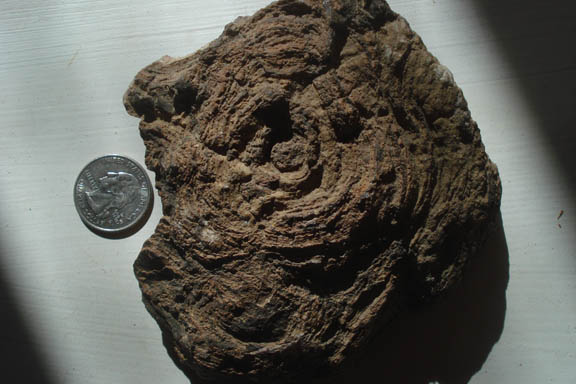
- 2374 Cross-sectional cutaway of small stromatolites from Australia.
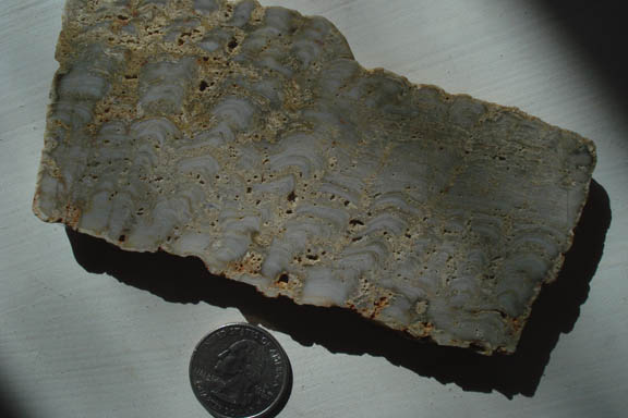
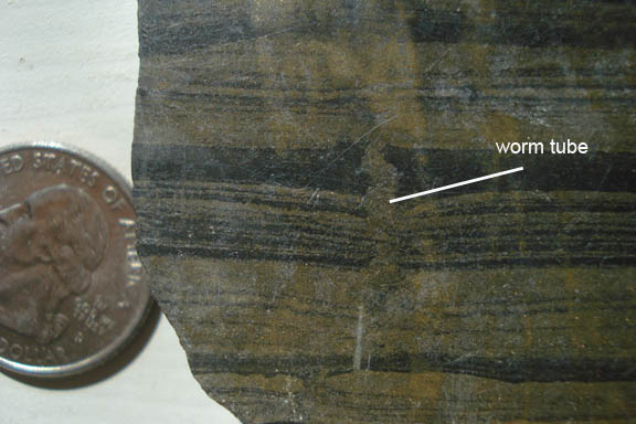
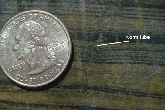
- 2375 and 2376 Marine burrowing worm tube from Sierra Ancha, central AZ. The tube is the wiggly vertical mass cutting through the sediment layering. The Apache Group beds are about 1,300 m.y. old, well before the 'Cambrian explosion' of life.
Interesting rocks:
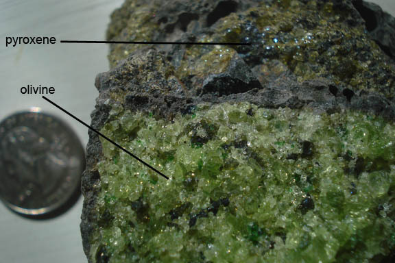
- 2377 Dark basalt rock (dark gray color) with a mantle inclusion with bright green crystals of olivine (peridot) and black pyroxene. From the San Carlos basalt field near Safford. About 2 m.y. old.
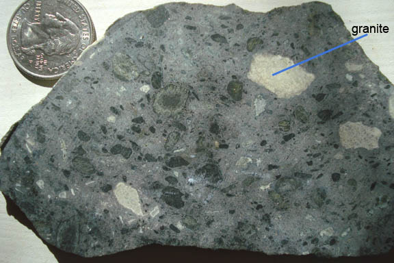
- 2378 Cross-section slab of kimberlite from a pipe in Wyoming. These are explosive events that bring up mantle rock and sometimes diamonds, as in this case at Sloan #2 pipe. The white masses seem to be granite-like rock. Age? -- about 60 m.y..
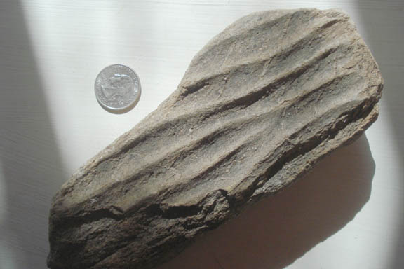
- 2379 Hard sandstone with preserved ripple marks from central Arizona near the Salt River Canyon. Found in older Precambrian sediments, about 1,700 m.y. old. Ripple waveforms are caused by gentle seafloor currents than surrounded islands before they crashed together to form up Arizona, this at the time depicted in Figure 5.
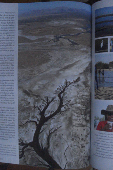
- 2424 Historic photo of the Colorado Delta region taken in 2015 during the river flushing event of 23 Mar-18 May when they let a slug of water out of Morelos Dam, causing the river to actually make it to the gulf region for the first time since the 1960s (excepting the wet El Nino winter of 1997-98). The 1944 treaty with Mexico gave about 10% of the long-term average flow to Mexico that is used for agriculture in Mexicali Valley. The narrow blue band in the distance in this photo is Colorado floodwater snaking its way towards the original mouth of the river which is below and behind the photo position. (source: Edible Baja Arizona magazine, July-August 2015, p. 100, photo by Seth Cothrun.) This photo shows a very tiny fraction of the delta deposits of the Colorado River -- sand, silt and clay washed down from Colorado, Utah, and Wyoming, and amounting to a volume of sediment washed into the delta of as much as 200,000 cubic miles (150x400x3 miles, my guess).
