Cabeza Prieta Natural History Association
Ajo Mountain Drive - Organ Pipe CNM

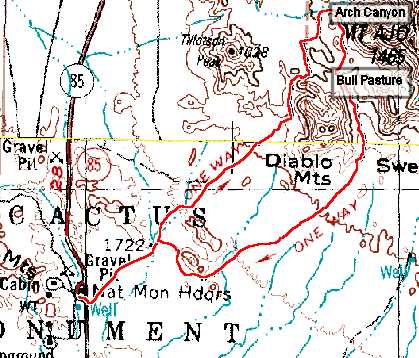
map bull pasture

Ajo Mountain Road

Ajo Mountain Drive is a 20 mile loop, dirt road, that is suitable for most passenger vehicles. The road is well marked with several informational stops.

GPS Coordinates, Mileage and Altitude

Ajo Mountain Drive Entrance 31.95387°N, 112.79949°W 0.0 miles, altitude 1645 feet
Arch Canyon Picnic Area and Trailhead 32.03842°N, 112.71587°W 9.5 miles, altitude 2540 feet
Estes Canyon/Bull Pasture Picnic Area and Trailhead 32.01619°N, 112.71182°W 11.1 miles, altitude 2330 feet


Copyright Creative Commons

HTML & Programing by
Thomas R. Powell